Project Description
Application Details
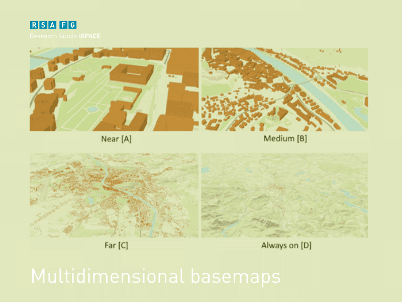
Four-dimensional, spatio-temporal high-resolution harmonised infrastructures for spatial informationa
From 2018 till 2019
The goal of the planned 4D-SDIs research project is to develop and validate models, concepts, adaptive workflows and implementation strategies for the design and implementation of high-resolution four-dimensional (spatio-temporal) spatial data infrastructures (4D-SDIs) and to optimize their design and operation with standardized, generalized and reusable workflows. This includes the extension of existing 2D spatial data infrastructures to 3D spatial data infrastructures, which now also include indoor and outdoor areas of public administration and service buildings as well as critical infrastructure facilities, and link the IoT components located therein in 4D-SDIs based on their location in space and time. This is necessary because in many cases, high-resolution 4D data sets in companies are often only available as isolated solutions because they are only organized in a technically proprietary way and are semantically coordinated with each other.
In the research project 4D-SDIs, extensions of 2D-SDI management strategies are designed, coordinated with user groups (e.g. administration and authorities) and based on this, technical ‘best practice’ prototypes are developed and validated. In detail, a prototypisation of the extension of existing (Austria-wide) harmonised and standardised 2D geodata models to standardised 3D and 4D geodata models and their organisation in data containers will be carried out. Based on available building modelling standards from different application domains (architecture, planning, geoinformatics), the information assets are to be harmonized and linked with semantic ‘loose-coupling’ strategies, independent of content and technical application, which will then form a stable foundation for the modelling of 3D and 4D environments of indoor and outdoor areas.
In summary, the 4D-SDIs research project aims to make infrastructure data with high spatial and temporal resolution technically standardized and harmonized for the various future tasks and requirements of digitization, such as maintenance, enterprise integration and support of security management for context-dependent enterprise / organizational information systems.
Our Research Team

Studio Management “Smart 4D Envoirnments”

Researcher

Researcher